Chengdu Plain Archaeological Survey (CPAS) 成都平原考古调查: 2005-2010年成果
Database of the surface survey points, coring locations and 'Activity Areas' of the Chengdu Plain Archaeological Survey 成都平原考古调查的地表调查采集点,钻探点和活动区域的资料库
Project Abstract
OVERVIEW
The Chengdu Plain Archaeological Survey (CPAS) was a regional archaeological project carried out in the Chengdu Plain of the Northwestern Sichuan Basin of China between 2005-2011. The CPAS aimed to understand change in site typology, centrality, distribution and density during the period of emerging social complexity in the Chengdu Plain and leading up to and including the transition to incorporation into the Han Empire c.2000 years BP. The aims of the project were to carry out regional survey archaeology in a region where this had previously not been done. Accordingly, the project was a methodological exploration of regional archaeology in a wet rice agricultural landscape. The research design aimed to examine areas around two late Neolithic walled centers to examine the emergence of regional political hierarchies and other changes in the spatial pattern of human activity. These sites are associated with the Neolithic Baodun culture (ca. 2550-1750 BCE). Regional evidence of complex society is particularly evident from the Sanxingdui culture known from the nearby site in Guanghan, and this culture constitutes one part of the Bronze Age for the region (ca. 1700-300 BCE). The vast majority of the prehistoric activity locations on the Chengdu plain lack any visible surface remains, and the intensive modification of the land surface in the CPAS survey area makes the use of traditional derived survey data difficult, so the CPAS developed approaches to data suited to local conditions.
Geography of Chengdu Plain
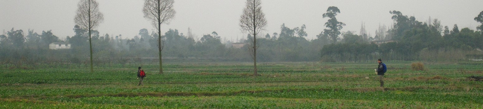
The Chengdu plain lies at the western side of the larger Sichuan basin in Southwest China. It is a fluvial landscape dominated by powerful rivers that drain from the Himalayan plateau. These rivers travel across a slightly sloping plain and have deposited alluvial soils and gravels across it. The plain itself is c. 500 m above sea level. The mountains immediately to its west reach up to 5000 m high. Historically, the Sichuan basin is one of the most productive agricultural regions of the world. For several millennia humans have managed and modified this landscape, creating canals and irrigation systems, and building up and maintaining a rich agricultural anthrosol across almost the entire plain. Augering regularly showed this anthrosol to be 2-3 m in depth. This is a landscape of wet rice paddies, their intervening small dykes, and settlements standing on slightly higher ground. These settlements tend to follow an asymmetric pattern of larger central places, today market and manufacturing towns and villages, and steady distribution of small farms and hamlets known as linpan 林盘. Small scale human action builds up and cuts down the landscape, slowly shifting settlements and field edges. In order to manage some of these challenges the CPAS work during the winter, when the paddy fields are used for vegetables and can be traversed on foot.
SIGNIFICANCE OF PROJECT AND APPLICATIONS OF DATA
Methodologically the CPAS makes two significant contributions. First and foremost it was a regional survey in a wet rice agricultural landscape that covered surfaces often inaccessible due to farming. Second, integrated approaches to this challenging survey landscape sought to both critically examine combined methods and to maximize the data collected in these conditions. The project report, (Chengdu Plain 2024; see chapter 23) contains several examples of integrated interpretations using the CPAS data. We combine topography, hydrology and recovered artifacts to build narratives of the life and uses of particular settlements and areas and use those to anchor larger diachronic interpretations of regional archaeology. In addition to these approaches, the CPAS data can be used in the same way as any regional survey might be used, to study the distribution of settlement sites and how that changed through time. However, the diffuse nature of data collected in this environment makes it difficult to get comparative specificity of site location, extent and chronology. The primary data here can be raw material for further more sophisticated quantitative analysis. The data here may be better suited to sample based studies, or by looking at the individual found items in a big data study.
OVERVIEW OF DATA
The CPAS data collection strategy was a sampled siteless survey strategy. Individual ceramic sherds, each with a specific location and chronological identification, were the primary data. The data here are drawn from both surface collection survey and sampling with auger cores. Analysis of the data integrates both types. The first type of data covers the entire survey area evenly, the second is drawn from a series of sample transects and spans the study area with a focus towards known central places. Though auger data collection strategy was designed to respond to areas where artifacts were found in the field, the majority of the interpretation of past activity on the landscape was done in the post-fieldwork phase of the survey. The data presented here include data at that stage, before post-fieldwork study and definition of “Activity Areas”, a term this project prefers to “sites” in most instances. The second set of data presented here follows the definition of activity areas and sites. These are the data and interpretations that are presented in the project’s report volume (Chengdu Plain 2024).
Data Structure
The core of the data here is elements of a relational database of c. 80,000 records organized into six tables of data, including primary data (waypoints, auger layers, bags, sherds and tombs sites) and one table derived from that data (areas). The working database of the CPAS project was a relational database built using FileMaker Pro. This database was designed to 1) take in original field data as it was produced in the field, 2) provide a virtual version of the field data — artifact bags, auger cores etc. for the data analyst, and 3) export data to be incorporated in the project’s GIS. The data presented here are the basic elements of that database. In these data tables there are three key values, waypoint, field catalog number (FCN), and area number. Every record of every table includes one or more of these key values in it. The three key values relate to one another in a string of one-to-many relationships, for example, one area may contain several waypoints and each waypoint may contain several FCN. The data in each record also had its own unique identifier, called “full waypoint” for the spatial data or “FCN” combined with “Sherd Number” for the individual sherds. The association of each sherd with an FCN and each FCN with a waypoint means that any individual artifact can be given a spatial context.
METHODS
For a complete description of the CPAS methods we refer you to Chengdu Plain (2024). Here a very brief workflow will be offered.
The CPAS integrated two methods of archaeological survey. Surface survey “fieldwalking” and sub-surface auger testing. Surface survey was carried out by teams walking at 50 m spacing across the entire survey area except where blocked by agricultural structures, village buildings, highways, or water channels. Large scale topographic maps and GPS units were used to guide the survey. Team members watched the ground surface as they moved, but their most effective tactic was to use trowels to make scrapes on the vast number of very small (c.20-80 cm) field boundary terraces that the survey lines crossed every 20-30 m. Individual surveyors documented their finds as they went. Augering teams moved across the landscape in long transects carrying out primary augur tests every 200 m. These transects often were carried out by two teams moving in parallel, creating a transect 400 m wide. At each primary point three of four auger cores were dug in close proximity, and if artifacts were found a cruciform pattern of lines of single auger cores extended out from the initial find until no more artifacts were found, and the extent of the scatter defined. Each column of soil from the auger cores was recorded as its characteristics changed. Any finds were recorded by their core layer and depth. Handheld GPS units guided auger teams and located surface finds.
All pottery sherds collected by the survey were returned to the central processing area and examined by a team of ceramicists who designated their chronology and recorded ware details. In the same lab space, the results from auger cores were transferred from their field forms into the project database. The average bag of artifacts contained only three or four objects, and almost all less than 12. The largest lot examined contained 56 items. Methods for defining activity areas were designed for these small numbers of objects spread over large areas.
Particularly notable areas detected by the survey were further examined through geophysics and excavation. These revealed such areas to be settlements of various sizes with a mix of pits, kilns, exterior hearths, structures, burials and sheet middens. These data are discussed in Chengdu Plain 2024.
Areas and Sites
The CPAS defined its activity areas (similar to “sites”) after data collection was complete. Though the survey was centered on known walled enclosures (the Gucheng and Yufucun sites), those known walled sites were not given precedence in the study of the data. Because the data from the CPAS used to make these areas is often drawn together from a large spread of collections and diffused through geomorphological conditions, the term activity areas was chosen because it is more general than the more defined and constrained “site”, and the discovery of the conventional elements of an archaeological site (structures, clearly defined scatter boundaries, topographic features) were a rare find on the CPAS. In total the CPAS defined 795 activity areas, some of which were known from previous non-systematic surveys of the same region, from opportunistic finds, or from two additional construction-related surveys within the survey zone that took place contemporaneously with the last stages of the CPAS project.
Area construction was carried out in a GIS. It can be described most simply as using buffers around findspots to link finds together and develop measures of areal extent from those linked groups of finds. The surface survey provided the encompassing structure of area discovery. Auger methodology had a predesigned and spatially regulated system of sub-surface scatter detection. Though each method alone could define an activity area, however many are combinations of these two methods. Basically, a 75 m buffer around surface survey was enough to link findspots, surface or auger, together. The rationale for this distance was that with the 150 m span of the full circle, three surface surveyors would pass over the area and hopefully detect any artifact scatter. Surface survey buffers were also able to link different auger find areas and grow activities areas across the landscape to encompass dozens of survey and auger findspots. This process was repeated for both all artifacts found and for each of the project's three chronological phases (Neolithic/Baodun, Bronze Age and Han). All the finds with each of these spaces were then associated with the activity area to form a pool of associated data points for further study.
All resulting combined areas had some organic structure to them, but the actual extent of the sub-surface artifact scatter is difficult to determine conclusively with low artifact counts and scattered collection points. For this reason the CPAS adopted a set of derived measurements to define and compare activity areas. Areal extent of a scatter as a whole was determined by calculating the area of an ellipse that encompasses the pool of points. To avoid find points defining boundaries and to mesh with the smallest search step in the auger strategy, the dimensions of the ellipse were increased by an extra 5 meters around the boundaries of the area so a single find point to give a minimum area value of 79 m2. Find depth ranges for each phase, and for the scatter as a whole, are recorded. Because of heavy modification to the soils of the Chengdu Plain, it might be expected that artifacts would be moved in the soil column. Surprisingly, though this data is widely variable, the trend of depth data (64% of activity areas with depth) falls into the chronological sequence of the major archaeological periods. Density uses basic artifact count over area for a scatter. This served mainly to identify types of scatters — wide and diffuse, small and dense etc. rather than to lead directly to interpretations. Ubiquity reflects the occurrence in the total number of units analyzed in an area of a certain period of material. This measure, and changes in it, provide a measure of the main period of use of the site.
CURRENT LOCATION OF COLLECTIONS
All artifact collections are stored in the Chengdu City Institute of Archaeology, Sichuan, China.
PROJECT PUBLICATIONS
Chengdu [Chengdu Shi Wenwu Kaogu Yanjiusuo 成都市文物考古研究所] (2009). Chengdu Shi Pi Xian Sandaoyan Songjiaheba Shang Zhou fajue baogao成都市郫县三道堰宋家河坝商周发掘报告 [Report on the excavation of the Shang / Zhou site of Songjiaheba in Sandaoyan, Pi County, Chengdu]. Chengdu kaogu faxian 成都考古發現 [Archaeological discoveries in Chengdu] 2007: 104-137.
Chengdu Pingyuan Guoji Kaogu Diaochadui 成都平原国际考古调查队 [傅罗文 (Rowan K. Flad); 江章华; 关玉琳 (Gwen Bennett; 提莫西‧郝思利(Tim Horsley); 陈伯桢; 贾什‧莱特 (Josh Wright)] (2010). Chengdu pingyuan quyu kaogu diaocha (2005-2007) 成都平原区域考古调查 (2005-2007) (2005-2007 archaeological survey in the Chengdu Plain). Nanfang minzu kaogu 南方民族考古 [Southern ethnoarchaeology]6: 255-278.
Chengdu Pingyuan Guoji Kaogu Diaochadui 成都平原国际考古调查队 (2012). Songjiaheba – Chengdu Pingyuan qingtong shidai xiaoxing juluo de tianye diaocha, fajue ji diqiu wuli kantan 宋家河坝──成都平原青铜时代小型聚落的田野调查,发掘及地球物理勘探 (Songjiaheba - Survey, geophyiscs and excavation at a small-scale Bronze Age settlement in the Chengdu Plain). Chengdu wenwu成都文物 [Cultural relics of Chengdu] 2012(1)
Chengdu Pingyuan Guoji Kaogu Diaochadui 成都平原国际考古调查队 (2015). Songjiaheba: Chengdu Pingyuan Qingtong shidai xiaoxing juluo de tianye diaocha, fajue ji diquiwuli kantan 宋家河坝:成都平原青铜时代小型聚落的田野调查,发掘及地球物理勘探 (Songjiaheba: The survey, excavation and archaeological geophysics at a small-scale Bronze Age settlement in the Chengdu Plain). Nanfang minzu kaogu南方民族考古 [Southern ethnoarchaeology] 11: 231-246.
Chengdu Plain [Chengdu Plain International Collaborative Archaeological Team 成都平原国际考古调查队] (2024). The Chengdu Plain Archaeological Survey – Catalog and Results . UCLA: Cotsen Institute Press.
[Chinese version to be published as: Chengdu Pingyuan Guoji Kaogu Diaochadui 成都平原国际考古调查队 (n.d.).Chengdu Pingyuan Kaogu Diaocha—2005-2011 nian chengguo成都平原考古调查 -- 2005-2011 年成果 [The Chengdu Plain Archaeological Survey – Results from 2005-2011]. Beijing: Kexue chubanshe. ]
Chengdu & Pi Xian [Chengdu Shi Wenwu Kaogu Yanjiusuo 成都市文物考古研究所 and Pi Xian Wangcongci Bowuguan 郫县望丛祠博物馆] (2016). Chengdu Pi Xian Boluocun Shang Zhou yizhi fajue baogao 成都郫县波罗村商周遗址发掘报告 (Report on the Shang/Zhou site at Boluocun in Pi County, Chengdu). Kaogu xuebao 考古学报 [Acta archaeologica sinica] 2016(1): 89-124.
Chengdu & Sichuan [Chengdu Shi Wenwu Kaogu Yanjiusuo 成都市文物考古研究所 and Sichuan Daxue Lishi Wenhua Xueyuan 四川大學歷史文化學院] (2014). Chengdu Shi Pi Xian Boluocun yizhi II qu fajue jianbao 成都市郫县波罗村遗址II区发掘简报 (Preliminary report on the excavation of Area II at the Boluocun site in Pi County, Chengdu]. Jianghan kaogu江漢考古 [Archaeology of Jianghan plain] 2014(3): 3-29.
Chengdu & Sichuan [Chengdu Shi Wenwu Kaogu Yanjiusuo 成都市文物考古研究所 and Sichuan Daxue Lishi Wenhua Xueyuan 四川大學歷史文化學院] (2020). Pi Xian Boluocun yizhi郫县菠萝村遗址 [The Boluocun site in Pi County]. Beijing 北京: Kexue chubanshe 科学出版社.
d’Alpoim Guedes, J., 2011. Millets, rice, social complexity, and the spread of agriculture to the Chengdu Plain and Southwest China. Rice, 4(3), pp.104-113.
d’Alpoim Guedes, J., Jiang, M., He, K., Wu, X. and Jiang, Z., 2013. Site of Baodun yields earliest evidence for the spread of rice and foxtail millet agriculture to south-west China. Antiquity, 87(337), pp.758-771.
Rowan Flad (2008) New Research Exploring the Origins of Sanxingdui. Backdirt: Annual Review of the Cotsen Institute of Archaeology 2008: 30-31.
Flad, R., 2013. The Sichuan Basin Neolithic. A Companion to Chinese Archaeology , pp.125-146.
Flad, R.K. and Chen, P., 2013. Ancient Central China: Centers and peripheries along the Yangzi river . Cambridge: Cambridge University Press.
Flad, R., Horsley, T.J., d’Alpoim Guedes, J., Kunyu, H., Bennett, G., Chen, P., Shuicheng, L. and Zhanghua, J., 2013. Survey, excavation, and geophysics at Songjiaheba—A small Bronze Age site in the Chengdu Plain. Asian Perspectives, 52(1): 119-142.
Horsley, T.J., Flad, R.K., Bennett, G.P., Shuicheng, L., Zhanghua, J. and Chen, P., 2009. Investigating ancient landscapes and settlement patterns in the Chengdu Plain, Sichuan, China. ArcheoSciences. Revue d'archéométrie , (33 (suppl.): 187-190.
Horsley, Timothy J. (2010). Diqiu wuli jishu zai Zhongguo Sichuan Chengdu Pingyuan kaogu gongzuo zhong de yingyong 2006 nian 12 yue - 2007 nian 1 yue 地球物理技術在中國四川成都平原考古工作中的應用 2006年12月-2007年1月(The utility of geophysical techniques in China based on archaeological research in the Chengdu Plain, Sichuan - Dec. 2006 - Jan. 2007). Nanfang minzu kaogu南方民族考古 [Southern ethnoarchaeology] 6: 279-294.
Jiang Zhanghua 江章华 and He Kunyu 何锟宇 (2016). Chengdu pingyuan shiqian juluo fenxi 成都平原史前聚落分析 (The distribution of settlements in the Chengdu Plain). Sichuan Wenwu 四川文物 [Sichuan cultural relics] 2016(6): 70-83.
Jiang Ming 姜銘, Jade D'alpoim Guedes and He Kunyu 何錕宇 (2011). Xinjin Baodun yizhi 2009 niandu kaogu shijue fuxuan jieguo fenxi jianbao 新津宝墩遗址2009年度考古试掘浮选结果分析简报 (Preliminary report on analysis of floatation remains from the 2009 excavations at Baodun in Xinjin). Chengdu kaogu faxian 成都考古發現 [Archaeological discoveries in Chengdu] 2009: 68-82.
Lin, K.C., 2019. On craft production and the settlement pattern of the Jinsha site cluster on the Chengdu Plain. Asian Perspectives, 58(2): 366-400.
Zhou Zhiqing 周志清 (2018). Chengdu pingyuan xianqin shiqi chutu xiangya yanjiu 成都平原先秦时期出土象牙研究. Zhonghua wenhua luntan中华文化论坛 [Forum on Chinese Culture] 2018(7): 4-9.
Zhou Zhiqing 周志清, Chen Jian 陈剑, Liu Xiangyu 刘祥宇 and Bai Tieyong 白铁勇 (2018). Chengdu pingyuan Xiejianghe he Xihe liuyu shiqian chengzhi kaogu diaocha 成都平原斜江河和西河流域史前城址考古调查 (Survey of the prehistoric walled sites along the Xiejianghe and Xihe Rivers in the Chengdu Plain.Chengdu wenwu成都文物 [Chengdu cultural relics] 2018(4): 1-8.
GIS LAYERS
A range of specialized GIS layers focused on the work of the CPAS and the topography of the Pixian area that might otherwise be difficult to obtain are available here. These layers are:
- Topographic lines, 1 m contour lines covering the entire survey area traced from 1:25000 surveyed maps
- Elevation points - a layer of elevation points, recorded to the 0.1 m. Points that were recorded on tomb mounds are not included in this layer.
- Hydrology (2 layers): One contains major rivers only, and the other all mapped channels including many modern irrigation canals as well as un-canalized streams.
- The CPAS survey extent polygon, single polygon showing the extent of the fully surveyed 10 km circle around the Gucheng site (CPAS Area 0001) and the portion of the circle around the Yufucun site (CPAS Area 0603) that was examined with both augering and surface survey.
- Survey tract boundaries, large working blocks used by the surface survey. These also show the areas covered by urban areas when the survey was being carried out.
- Walls and walled sites - point layer showing the locations of identified walled sites in the survey area.
- Geophysics unit, polygons that show the exact areas covered with geophysical techniques by the CPAS. At some areas there are multiple polygons.
LIST OF DATA IN TABLES
The following tables are included here. Fields flagged as 'Key Fields' exist in multiple tables and can be used to create relationships within the database. Those flagged as 'Unique Values' are unique to the record in which they are found.
Table 1: Waypoints (LINK)
This table includes data on where, when and through what type of survey method things were found by the CPAS. This is basically a record of GPS data recorded by the CPAS.
|
Field |
Key Field |
Unique Value |
Description |
|
Waypoint |
X |
X |
The waypoints recorded originally by the CPAS. Format is Year-Project-GPS Unit-Point number. |
|
Central_Core_Point |
X |
Either the first primary auger point of a group of cores or the waypoint of a surface find |
|
|
CPAS_Area |
X |
The area number in which the waypoint is included. |
|
|
Season |
The field season in which the waypoint was recorded. |
||
|
Easting |
UTM Coordinate. All in zone 48R |
||
|
Northing |
UTM Coordinate. All in zone 48R |
||
|
Point Type |
Which type of survey recorded the point |
||
|
All_FCN |
X |
X |
Field catalogue numbers associated with this waypoint. |
|
Full_Waypoint |
X |
X |
Waypoint with auger group position, primary or secondary, appended. For surface finds it is the waypoint alone. |
|
Land_Type |
Immediate surface conditions around the waypoint location |
||
|
Anthropogenic_Soil |
Was archaeologically typical anthropogenic soil noticed in a core (regardless of artifact recovery) |
||
|
Primary_Point |
Identifies the points that are used to begin the area creation process. These are the first of each primary auger group (desigated ‘X’), any survey find (‘X_S’), and the systematically selected block primary points (‘X-B’). |
||
|
Final_Depth |
The deepest depth reached by a core. |
Table 2: Field Catalog Numbers (LINK)
This table includes the information that gives the waypoints their chronological attribution and is the most used basic source of information on activity across the survey area in different periods. Bags (each with an FCN) are the basic unit in which artifacts were recovered, but the examination of individual sherds in those bags (see table 3) forms the basis of the key information in each FCN.
Because sherd identifications were primarily carried out after field data collection, the survey brought sherds from outside its chronological focus to the lab. This table includes several columns counting those sherds. These have been identified in the description with an ‘*’.
|
Field |
Key Field |
Unique Value |
Description |
|
FCN |
X |
X |
Field Catalog Number of the artifact bag |
|
Bag_Full_Waypoint |
X |
Equivalent to Full Waypoint. Multiple FCN may be associated with a single Full Waypoint if there are multiple bags of artifacts found by a single core. |
|
|
CPAS_Area |
X |
The site area number where the bag was found. |
|
|
Central Core Waypoint |
X |
Either the first primary auger point of a group of cores or the waypoint of a surface find |
|
|
CPAS_Area |
X |
The area number in which the waypoint is included. |
|
|
Bag_Number |
If multiple bags were recovered in the same waypoint they each receive a sequential number and a unique FCN |
||
|
Bag_total_sherds |
The number of sherds in the bag |
||
|
Contents |
Artifact type in the bag as recorded by field team |
||
|
Easting |
UTM Coordinate. All in zone 48R |
||
|
Northing |
UTM Coordinate. All in zone 48R |
||
|
Core_Level |
A sequential value that records level of a core the FCN was found in. Higher values are deeper in the core. |
||
|
Find_Depth |
For auger finds, the depth in cm below the surface |
||
|
Architecture |
What architectural remains were found with the FCN |
||
|
Decorated Bricks |
If decorated bricks were present at the FCN point. |
||
|
Baodun_Sherds |
The number of Baodun sherds in the FCN. |
||
|
Shang_Zhou_Sherds |
The number of Shang_Zhou era (Bronze Age) sherds in the FCN. |
||
|
Warring_States_Sherds |
The number of Warring States period sherds in the FCN.* |
||
|
Warring_States_to_Han Sherds |
The number of sherds dated between Warring States and Han in the FCN.* |
||
|
Pre-Qin Sherds |
Sherds dated only as before Qin in this FCN.* |
||
|
Total_Bronze_Iron_Sherds |
The summed number of Shang and Zhou,Warring States and Pre-Qin sherds in the FCN. |
||
|
Han_Sherds |
The number of Han period sherds. |
||
|
Post_Han Sherds |
The number of sherds identified only as after the Han era.* |
||
|
Tang_Sherds |
The number of Tang era sherds.* |
||
|
Song_Sherds |
The number of Song era sherds.* |
||
|
Post_Song_Sherds |
The number of sherds identified only as after the Song era.* |
||
|
Ming_Sherds |
The number of Ming era sherds.* |
||
|
Total_Post_Han_Sherds |
The sum of the numbers of sherds from all the Post-Han historical periods |
||
|
Unidentified_Sherds |
The number of unidentified sherds |
||
|
Total_Han_and_Earlier |
The sum of sherds from all the periods on which the CPAS was focused. |
||
|
Total_Sherds |
The total number of sherds of all periods in the bag. |
Table 3: Artifacts / Sherds (LINK)
The table includes every sherd and its structural, formal and chronological attributes. These data are used to virtually re-assemble bags of artifacts (see table 2, the FCN table).
|
Field |
Key Field |
Unique Value |
Description |
|
FCN |
X |
The field catalogue number from which the sherd comes |
|
|
Sherd_Number |
Identifies the individual sherd within the FCN |
||
|
Bag_Number |
The same as the bag number from the FCN table. |
||
|
CPAS_Area |
X |
The site area number where the artifact was found. |
|
|
Cultural_Affiliation |
The most precise identification of the sherd possible. |
||
|
Chronology |
Chronological period used by CPAS to which the sherd belongs. |
||
|
Paste |
Paste of the sherd |
||
|
Part |
Vessel part of the sherd |
||
|
Surface |
Surface treatment of the sherd |
||
|
Type |
Vessel or object form |
||
|
Publication |
Where the sherd has been published |
||
|
Figure_No |
Published figure number |
||
|
Image_type |
Type of image in publication |
Table 4: Layers (LINK)
The table contains data on every identified layer in every individual auger core carried out by the CPAS. It records soil characteristics and depth data.
The empty spaces between Activity Areas that contain only a few single-sherd finds and long series of auger cores recording soil profiles provide informative, and interpretable, detail about the non-site spaces examined by the CPAS.
|
Field |
Key Field |
Unique Value |
Description |
|
Core_Waypoint |
X |
The waypoint of the core from which the layers comes |
|
|
Layer_Full_Waypoint |
X |
Waypoint with auger group position, primary or secondary, appended. |
|
|
Level |
Sequential depth in the core that |
||
|
Layer_Full_Level |
X |
X |
Full waypoint combined with level to produce a unique value for each layer. |
|
Top depth |
In cm below surface |
||
|
Bottom depth |
In cm below surface |
||
|
Layer volume |
Volume in cubic meters based on the depths and diameter of the auger bucket |
||
|
Soil |
The identification of the soil in the layer |
||
|
CPAS_Soil_Type |
CPAS numbering of different soil types |
||
|
Munsell |
The color of the layer soil |
||
|
Munsell_RGB_Number |
Munsell converted into computer displayable RGB color code. |
||
|
Secondary_Layer_Munsell |
A second color reading for mottled soil |
||
|
Secondary_Layer_RGB |
Secondary munsell converted into computer displayable RGB color code. |
||
|
Charcoal |
Was charcoal flecking visible in the layer |
||
|
Bottom_layer_flag |
Notes if this layer is the lowest layer in its core |
Table 5: Areas (LINK)
This table aggregates data about activity areas. Individual areas have multiple rows in this table. One for each main period (BD,SZ,HN) and one for all periods (AP)
|
Field |
Key Field |
Unique Value |
Description |
|
Area Number |
X |
Site area number. The same value is used for all periods. |
|
|
Period |
Which of the three main periods (BD,SZ,HN) of activity in a site area does this row show, or an all periods (AP) total for the area. |
||
|
Site Name |
Site name for the area. Often the name is used in existing publications. |
||
|
Site_Name_Chinese |
|||
|
WWPC_ID |
X |
The Wenwu Pucha or other previous catalog number of the site |
|
|
Phases |
Which of the three main periods are present at the site |
||
|
Phase_Count |
The number of phases present in each area. |
||
|
Center_Easting |
UTM Coordinate. All in zone 48R |
||
|
Center_Northing |
UTM Coordinate. All in zone 48R |
||
|
Bag Count |
The number of artifact bags (FCN) included in the area |
||
|
Sherd Count |
The number of sherds included in the area |
||
|
Average_Depth |
The average depth, not including surface finds, in cm below surface of sherds found in the area |
||
|
Find_Depth_SD |
The standard deviation of find depths. A value getting at the thickness of the layer. |
||
|
Area_Bottom |
Depth in cm below surface of the lowest find in the area. Surface finds have a depth of 0. |
||
|
Area_Top |
Depth in cm below surface of the highest find. |
||
|
Max_Layer_thickness |
Thickness of the layer derived from top and bottom depths. |
||
|
Total_number_of_Cores |
All cores in a site area. |
||
|
Total_number_of_secondary_cores |
Number of secondary cores made, regardless of contents |
||
|
Secondary_core_positives |
Number of secondary cores with artifacts |
||
|
Area_Size |
The area of the ellipse that encompasses all the waypoints of the particular period in the site. |
||
|
Sherd_Density |
Density of sherds per hectare in a particular area. |
||
|
Ubiquity |
Percentage measure of how common artifacts of one period are in an area |
Table 6: Tombs (LINK)
Mounded tombs recorded in the CPAS survey area by the survey itself.
|
Field |
Key Field |
Unique Value |
Description |
|
Tomb Number |
X |
Sequentially numbered tombs |
|
|
Site_Name |
Site name for the area. Often the name is used in existing publications. |
||
|
Site_Name_Chinese |
|||
|
Type |
If the tomb has a mound structure, the default value is a tomb without a mound. |
||
|
Period |
What chronological affiliation is attached the the tomb site. |
||
|
Core Waypoint |
X |
The waypoint associated with the tomb site |
|
|
Area Number |
X |
What site area the tomb is associated with |
|
|
FCN |
X |
What FCN the tomb is associated with |
|
|
UTM_Easting |
UTM Coordinate. All in zone 48R |
||
|
UTM_Northing |
UTM Coordinate. All in zone 48R |
||
|
Remains at Site |
Notes if architectural brick, decorated brick, tile, or ceramics where recorded at the site. |
Funding
A grant from the Shelby White and Leon Levy Program for Archaeological Publications provided financial support for this project.
.Suggested Citation
Chengdu Plain International Collaborative Archaeological Team 成都平原国际考古调查队 (Rowan K. Flad 傅罗文, Joshua Wright, Lin Kuei-chen 林圭侦, Zhou Zhiqing 周志清, Jiang Zhanghua 江章华). (2025) "Chengdu Plain Archaeological Survey (CPAS) 成都平原考古调查: 2005-2010年成果". Released: 2025-06-21. Open Context. <https://opencontext.org/projects/968ea7e8-d521-4b4c-951c-01adcac7307f> DOI: https://doi.org/10.6078/M7MS3QWC
Editorial Status
●●●○○Copyright License
To the extent to which copyright applies, this content
carries the above license. Follow the link to understand specific permissions
and requirements.
Required Attribution: Citation and reference of URIs (hyperlinks)
