Charcoal Hearths along the Blue Mountain of Pennsylvania
Identification of historic charcoal hearths in the landscape of the Blue Mountain via analysis of LiDAR
Project Abstract
The data contained within this project are the result of a long term research program directed by Benjamin Carter. The goal of the project is four-fold:
- First, it is a project that is designed to engage students in hands-on, experiential learning. This project has been utilized by students in the following courses; Historical Ecology, Field Archaeology, Senior Seminar in Anthropology, Historical Ecology of the Lehigh Valley (a "cluster course" that was paired with Dr. Kimberly Heiman's Crisis Earth course). Students have been involved in other aspects. One student, Heather Lash, was directly involved in the data described in this collection. Another students, Weston Conner, has devised a a method for identifying charcoal hearths on flat areas (not described herein).
- Second, the project is also designed to demonstrate, to students, community members and others that, though we often see landscapes through a contemporary lens, they are a palimsests; the overlapping and partially obfuscated results of hundreds (or thousands) of years of human engagement with the land and environment. Much of the area in question is contained within State Game Lands #217 and it is bisected by the Appalachian Trail- as such people see it as "wild" and "natural," but our study demonstrates that, only a little more than one hundred years ago it was an industrial landscape that would have been marked by widespread clearance of the forests and numerous charcoal hearths slowly releasing acrid smoke.
- Third, the project developed out of the Carter's interest in using open data and free-and-open-software (FOSS). This project is made possible because the State of Pennsylvania (through PAMAP) has made the original post-processed LiDAR data available as well as derivatives (Pennsylvania Department of Conservation and Natural Resources 2018, n.d., 2006b, 2006c, 2006a). Using only FOSS- specifically LASTools (https://rapidlasso.com/lastools/) and QGIS (https://qgis.org/), I was able to identify 758 potential charcoal hearths within the research area. Not only are FOSS tools effective, they also open up the range of potential users. This project, therefore is an ethical attempt to execute research that is easily replicable. Of course, this is also the reason that the data is published in Open Context and Zenodo.
- Finally, the project employs one of the most important innovations in archaeological research in the past decades, LiDAR (Light Detection and Ranging). This laser technology allows the high resolution mapping of the ground surface- something that was impossible until just the last few decades. This study is particularly important because it demonstrates the reuse of LiDAR data that was not collected for archaeology, but because it was provided openly by Pennsylvania, it can be use for archaeological purposes. LiDAR data is widely available; see Open Topography (http://www.opentopography.org/) and United States Interagency Elevation Inventory (https://coast.noaa.gov/inventory/).
The data provided herein are a relatively simple data set that demonstrates and records the techniques used to identify 758 charcoal hearths. The data includes a polygon that identifies the research area (in GeoJSON format) and three raster files (GeoTiffs); a DEM, a hillshade and a slope analysis. It also provides the points (GeoJSON) that have been identified through the close examination of the slope analysis.
References
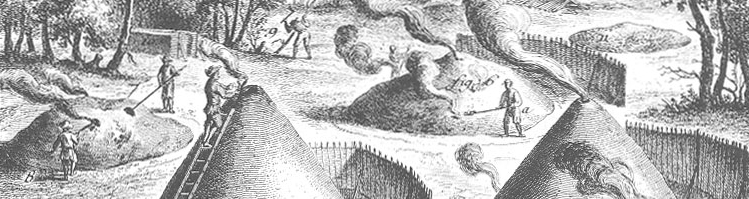
Banner- Source: "Agriculture and Rural economy – Charcoal." The Encyclopedia of Diderot & d'Alembert Collaborative Translation Project. Ann Arbor: Michigan Publishing, University of Michigan Library, 2010. Web. Accessed 28 May 2018. [http://hdl.handle.net/2027/spo.did2222.0001.346]. Trans. of "Agriculture et économie rustique – Charbon de bois," Encyclopédie ou Dictionnaire raisonné des sciences, des arts et des métiers, vol. 1 (plates). Paris, 1762.
Suggested Citation
Benjamin Carter. (2020) "Charcoal Hearths along the Blue Mountain of Pennsylvania". Released: 2020-12-11. Open Context. <https://opencontext.org/projects/289c201f-837f-4535-b039-5fa1f9b731bd> DOI: https://doi.org/10.6078/M7DV1GZF
Editorial Status
●●●○○Copyright License
To the extent to which copyright applies, this content
carries the above license. Follow the link to understand specific permissions
and requirements.
Required Attribution: Citation and reference of URIs (hyperlinks)
