
Document Content
Daily Log
June 18, 2002
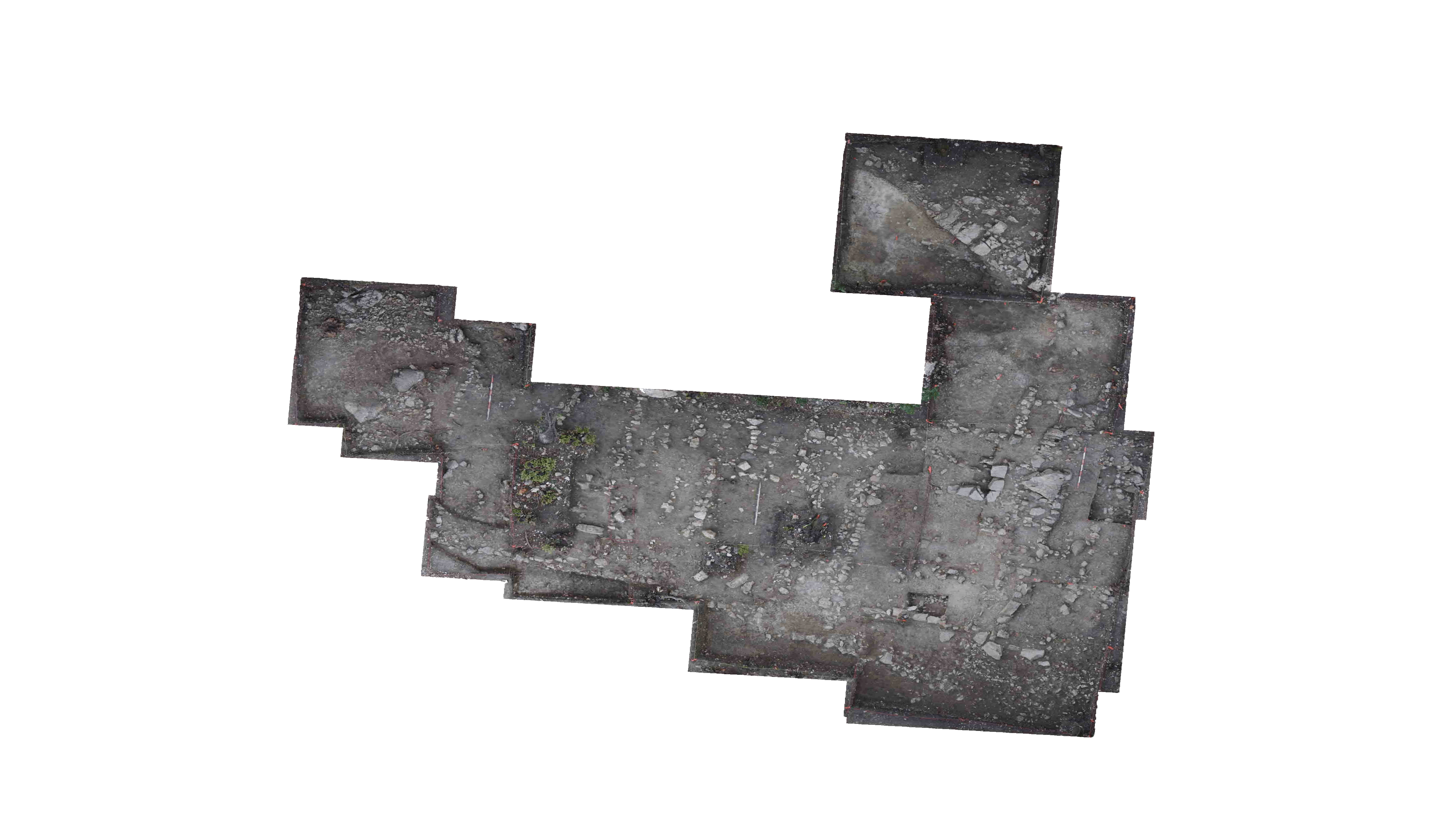
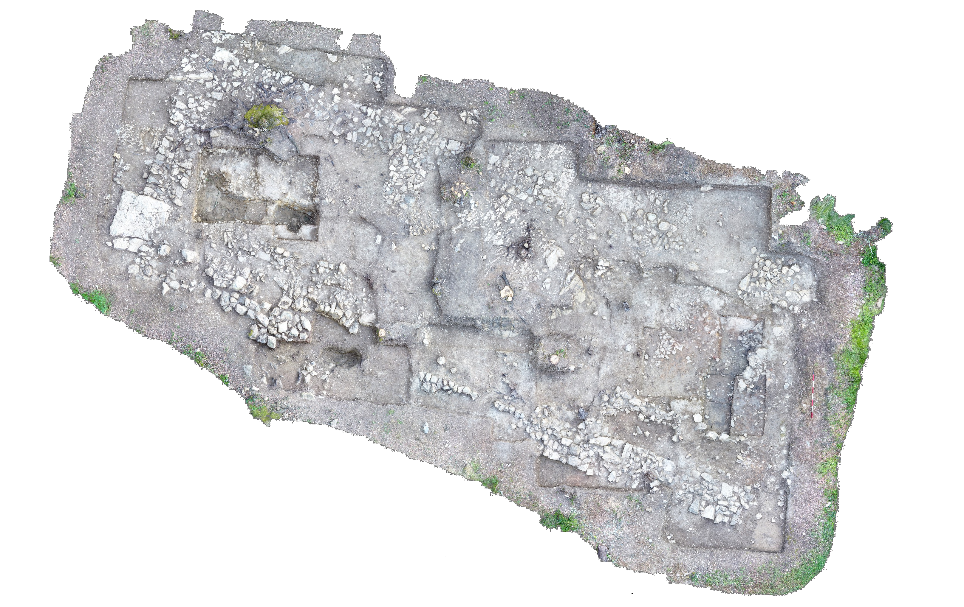
Photographs were taken in the morning focusing around the rock feature. After photos were done excavation continued in the trench. Locus 2 completed the cut from the previous day and then the baulk walls were trimmed. Due to the amount of rocks present in the locus, several were removed after it was decided that they did not belong to the rock feature. Trimming was also continued around the stump in the Northwest meter. Locus 2 produced 1/3 cassette terracotta and 2 fragments of pottery.
Locus 4 completed the cut from the previous day. Another cut was begun below the rock feature in the nothern meters of the locus. After this cut was completed,` Locus 4 was closed and Loci 8 and 9 were defined in order to distinguish the rock feature from the soil below. The baulk walls were then trimmed.
Locus 4 produced 1/4 cassette of terracotta and 28 fragments of pottery and Locus 9 produced 1 latte box of terracotta and one fragment of pottery.
The cut in Locus 1 was finished from the previous day and then Locus 1 was closed. Locus 5 and Locus 6 were established due to a difference in moisture. However after a few hours it became evident that the loci were in fact the same soil. A cut was made in Locus 5 and the stump from the Northeast corner was removed. When it was discovered that Loci 5 and 6 did in fact equate,
Locus 5 opening elevations
- 78S/198E 24.33m ae
- 78S/200E 24.51m ae
- 79.14S/200E 24.12m ae
- 79.18S/198E 24.27m ae
Locus 6 opening elevations
- 200E/80S 23.86m ae
- 199E/80S 23.85m ae
- 199E/79.16S 23.86m ae
- 200E/79.14S 23.88m ae
Locus 7 opening elevations
- 198E/78S 24.31m ae
- 198E/79S 24.30m ae
- 199E/79S 24.22m ae
- 199E/80S 23.88m ae
- 200E/80S 23.86m ae
- 200E/78S 24.27m ae
- 200E/79S 23.93m ae
Locus 8 opening elevations
- 196E/80S 23.80m ae
- 197E/80S 23.76m ae
- 198E/80S 23.68m ae
- 196E/80.65S 23.64m ae
- 197E/80.65S 23.61m ae
- 198E/80.65S 23.64m ae
Locus 9 opening elevations
- 196E/80.65S 23.64m ae
- 197E/80.65S 23.61m ae
- 198E/80.65S 23.64m ae
- 198E/82S 23.29m ae
- 197E/82S 23.41m ae
- 196E/82S 23.44m ae
| Descriptive Attribute | Value(s) |
|---|---|
| Document Type | Trench Book Entry |
| Trench Book Entry Date | 2002-06-18 |
| Entry Year | 2002 |
| Start Page | 36 |
| End Page | 43 |
| Title | Daily Log |
| Descriptive Attribute | Value(s) |
|---|---|
| Is Part Of Vocabulary: DCMI Metadata Terms (Dublin Core Terms) | KLH V Vocabulary: Murlo |
Suggested Citation
Kristin L. Hostetler. (2017) "KLH V (2002-06-18):36-43; Daily Log from Europe/Italy/Poggio Civitate/Tesoro/Tesoro 28/2002, ID:487/Locus 1". In Murlo. Anthony Tuck (Ed). Released: 2017-10-04. Open Context. <https://opencontext.org/documents/3d585ea8-9e7d-44bb-9cd3-f7a5238bb165> ARK (Archive): https://n2t.net/ark:/28722/k23n2fs4g

Copyright License
To the extent to which copyright applies, this content
carries the above license. Follow the link to understand specific permissions
and requirements.
Required Attribution: Citation and reference of URIs (hyperlinks)
