
| Descriptive Attribute | Value(s) |
|---|---|
| Locus Number | 3 |
| Legacy Database LocusID | 879 |
| Legacy Database TBTID | 352 |
| Locus Year | 2010 |
| Open Date | 2010-07-29 |
| Close Date | 2010-07-29 |
| Open Page | 53 |
| Close Page | 59 |
| Soil Samples | False |
| Photos | False |
| Munsell Color | dry: 10 YR 5/4 yellowish brown, wet: 10 YR 4/4 dark yellowish brown |
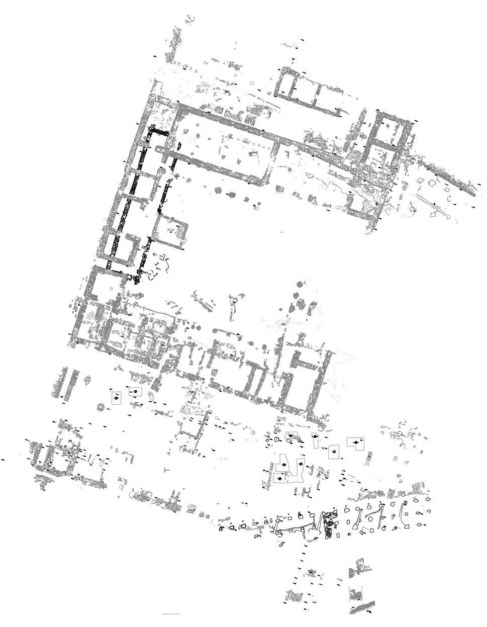
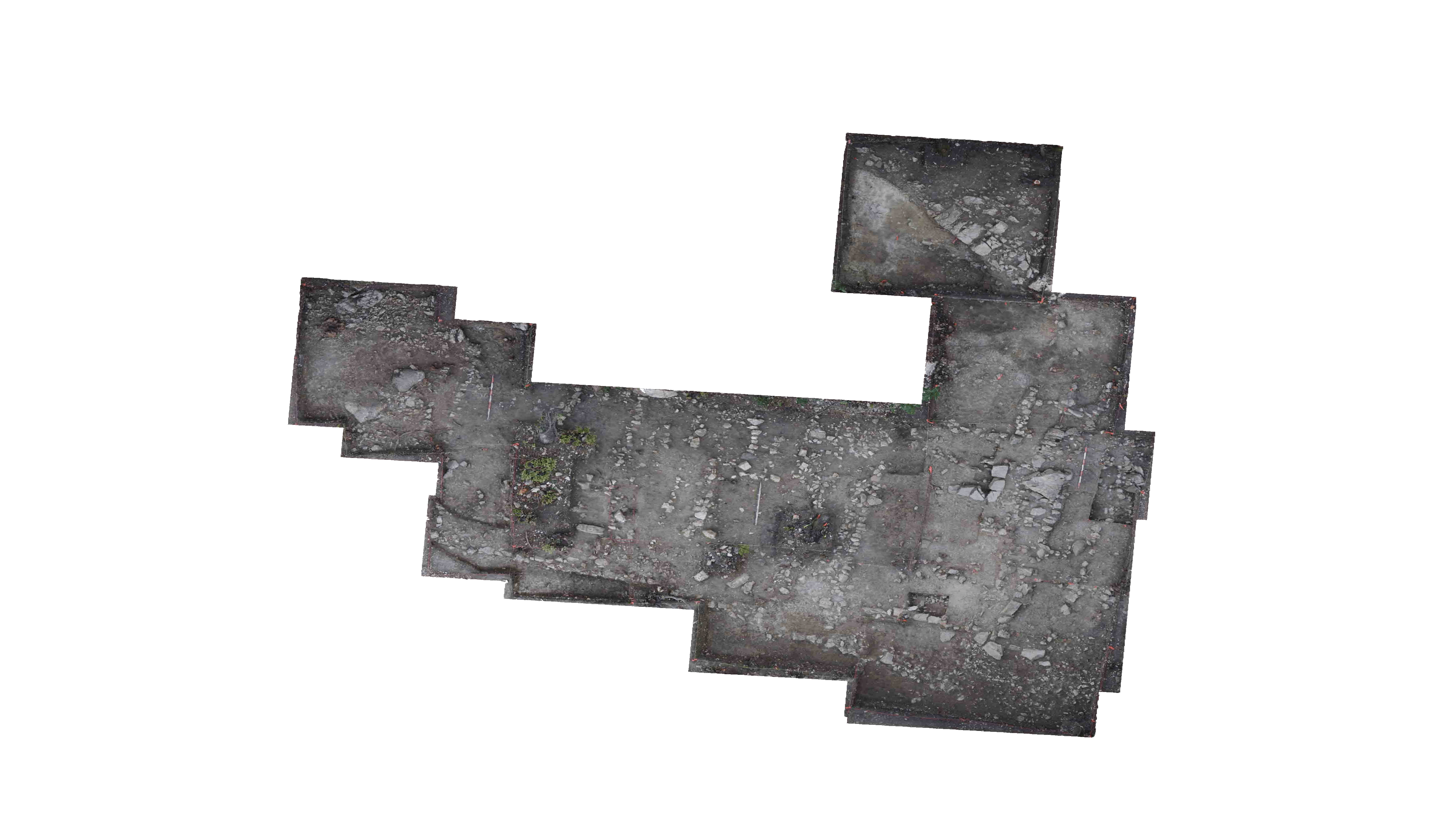
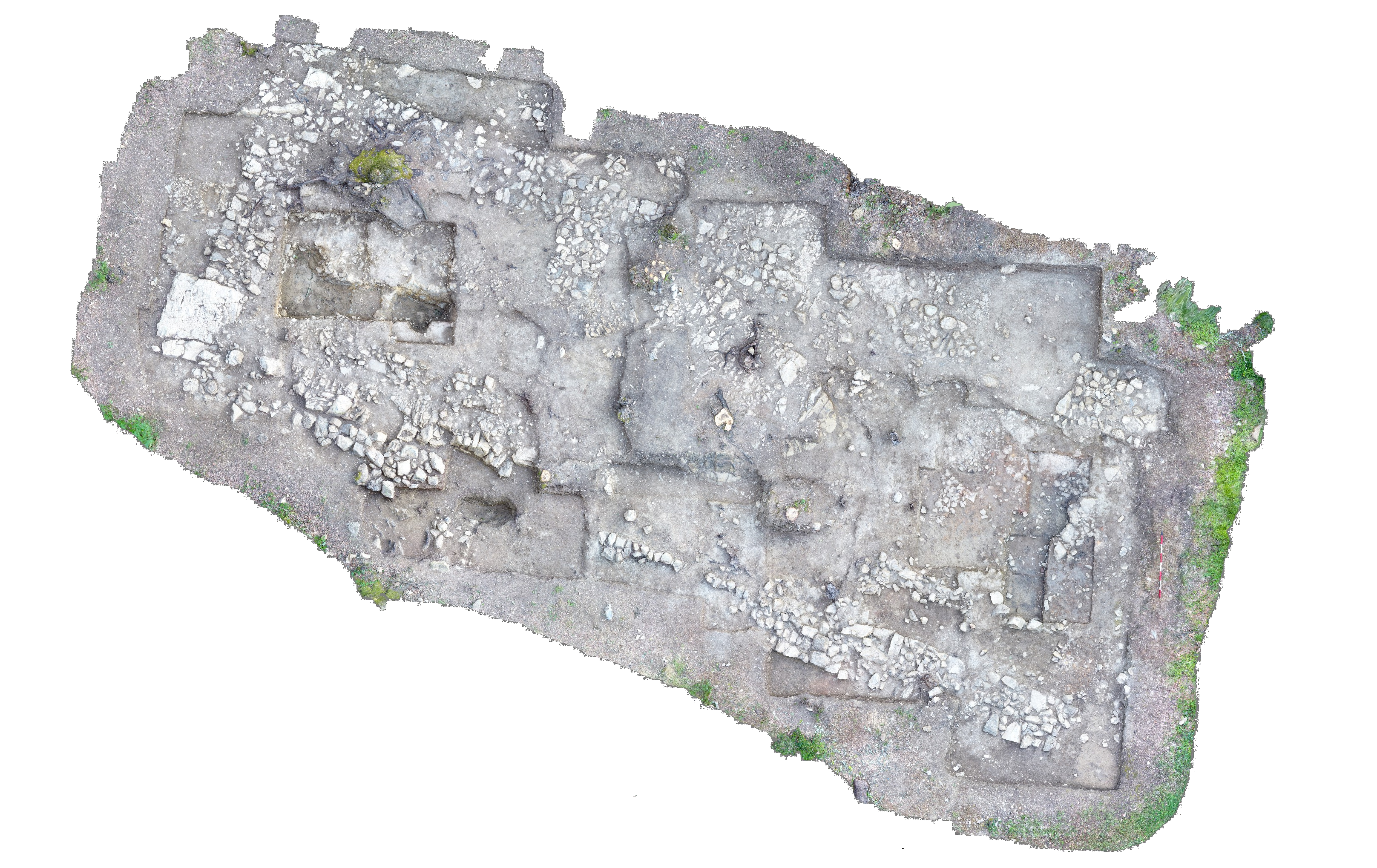
| Description | Locus 3 is the layer of galestra between the S bedrock shelf, the central stump, and the N bedrock shelf. It is devoid of any man-made finds but contains soome organic materials such as roots and insects. It is easy to pick through, except where roots or rocks interfere. The soil is yellowish brown with a chalkier and sandier texture than the topsoil. Locus 3 also consists of decaying limestone. Locus 3 still exsists in the trench, but was closed with the trench. |
| Descriptive Attribute | Value(s) | ||||||||||||||||||||||||
|---|---|---|---|---|---|---|---|---|---|---|---|---|---|---|---|---|---|---|---|---|---|---|---|---|---|
| Opening Grid Coordinates |
| ||||||||||||||||||||||||
| Closing Grid Coordinates |
|
Suggested Citation
Anthony Tuck. (2017) "Locus 3 from Europe/Italy/Poggio Civitate/Civitate A/Civitate A 68/2010, ID:627". In Murlo. Anthony Tuck (Ed). Released: 2017-10-04. Open Context. <https://opencontext.org/subjects/84141491-a2dc-477f-a528-2268b17da0c8> ARK (Archive): https://n2t.net/ark:/28722/k2w382r2d

300 m
1000 ft
Leaflet Map data: © MapBox.com, See: Poggio Civitate State Plan, See: Poggio Civitate Domestic Area, See: EPOCH4 Area Orthorectified Photo, Map data: © Google.com
Location data available with no intentional reduction in precision, and no documented estimates of precision or accuracy.
Copyright License
To the extent to which copyright applies, this content
carries the above license. Follow the link to understand specific permissions
and requirements.
Required Attribution: Citation and reference of URIs (hyperlinks)
