The Čḯxʷicən Fishbone Project
A Report on Methods and Descriptive Summary of Identifications and Primary Data Set
Project Abstract
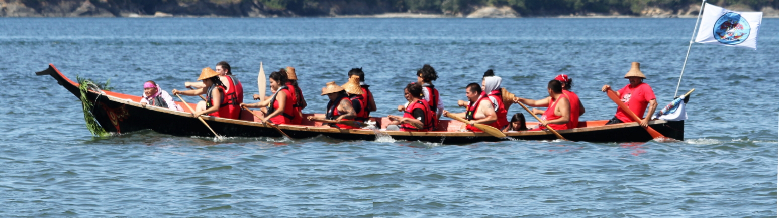
Banner photo credit: Lower Elwha Klallam Tribe on Canoe Journey, 2019, photo used with permission by Keri Ellis and LEKT
Overview
The Čḯxʷicən site is a Lower Elwha Klallam Tribe (LEKT) village in Port Angeles, WA, U.S.A., at the base of Ediz Hook on the south shore of the Strait of Juan de Fuca that was occupied for the past 2,700 years (Larson 2006). In 2004, Larson Anthropological Archaeological Services (LAAS) and LEKT members excavated the site with large open blocks of 1 x 1 m units by finely defined stratigraphic layers (Reetz et al. 2006). In 2012, Kristine Bovy (University of Rhode Island), Virginia Butler (Portland State University [PSU]), Sarah Campbell (Western Washington University), Michael Etnier (Western Washington University), and Sarah Sterling (PSU) initiated a research project focusing on Čḯxʷicən’s faunal remains and geo-archaeological records from the 2004 mitigation. As part of project design, we selected to study excavation areas that were linked to two possible plankhouses, to include interior and extramural deposits.
The Fishbone Project includes a report on methods including analysis criteria for taxonomic identifications; and the primary data file. The Fishbone Project is part of a larger zooarchaeological-geoarchaeological project, The Čḯxʷicən Project.
You may dynamically explore the data by clicking on "Data Records" at the right side of the screen or download a static CSV file of all 19,863 records in the Čḯxʷicən Fishbone dataset.
Support
Funding for this project came largely from the National Science Foundation [grant numbers 1219468, 1353610, and 1663789].
Definitions/Explanations for Column Headings for Fish Faunal Data
By Virginia Butler
Note: These definitions are also available as a downloadable PDF, The Čḯxʷicən Fishbone Project: Methods, Analytic Protocols, and Descriptive Summary for the 2012-2019 Analysis
Fish_ID
Faunal Identification Number—this is a unique identifier for this specific row/line. Note that each row/line may represent multiple specimens (see “Quant_Fish” below).
The animal categories are marked as follows: invertebrates begin with “S” (shellfish); fish, “F”; birds, “B”; and mammals, “M”.
Catalog Number
Catalog numbers match the artifact and faunal specimen inventory maintained by the Burke Museum. Catalog numbers take one of two basic formats depending on whether they were collected in situ during the excavations or if they were collected in the water screens.
Most samples included in our 2012-2019 project were collected from water screens and are designated as “WS” (e.g., “water screen”) catalog numbers. Because of various issues (see Butler et al., 2018a), the project team re-screened all the water-screened samples in our study. This process led us to create a slightly revised catalog system (from the original LAAS/Burke Catalog) with FOUR sub-numbers.
WS-16788.99.04.21
The number after the WS- is the “bag number” (see “Bag Number” below), which is the number assigned by LAAS lab/field personnel (Kaehler and Lewarch, 2006) with numbers assigned in the order in which the Unit/Level bags were added to the Master Catalog. The bag number can range from one to five digits. The “99” after the bag number specifies that this sample was re-screened by the 2012-2019 project.
The “04” in the example above designates the screen size fraction for that particular entry (here, ¼ -inch). Screen size designations are as follows:
01 1-inch
02 ½ -inch
04 ¼ -inch
08 ⅛ -inch
99 <⅛ -inch
The final sub-number (“21” in the example above) specifies the main animal type to which the sample belongs. Those categories are:
10 Invertebrate
20 Unidentified Vertebrate (non-fish)
21 Mammals
22 Birds
23 Fish
Samples collected in situ, termed “E” samples (see “Bag Type” and “Analytical Bag Type” below), maintain their original Master Catalog number from the LAAS/Burke Museum. The numbering system begins with the excavation area/block designation (Area A4 in the following example):
A4-197.01.01
The number after the dash (197) refers to the Field Bag number, which can be matched to bag numbers listed in the Unit/Level records (Kaehler and Lewarch, 2006). Explanations for the two sub-numbers after the Bag Number are described in Appendix 5 of the LAAS report (Larson, 2006, Appendix 5: pg 4)
BagNumber
This is the first number of the Catalog Number (see above), which is the
number assigned by LAAS lab/field personnel (Kaehler and Lewarch, 2006)
with numbers assigned in the order in which the Unit/Level bags were added
to the Master Catalog. This is the original bag number as it appears in the
LAAS/Burke Museum catalog.
Analytic_BagNum
In most situations, “Analytic_Bag Number” and “BagNumber” are the same.
However, as explained by Butler et al. (2018a), we encountered situations
where it appeared that constituents from a single original field bag/bucket
were split into >1 Bag Numbers during laboratory processing. Butler et
al. (2018a) explain how this was deduced. The Analytic Bag number is the
team’s best identification for the complete, 10 L water-screened bucket
that had later been subdivided; and is used when estimating excavation
volume for calculations of density/accumulation rate.
Re-screened
This duplicates the sub-number information in the Catalog Number (see above). All of the water-screened samples have the “0.99” code to indicate these were re-screened as part of the 2012-2019 project. The “E” samples—those that were collected in situ during excavation, were not re-screened.
ScreenSize
This duplicates the sub-number information in the Catalog Number (see above). This refers to the mesh size from which the constituents were recovered as noted above.
01 1-inch
02 ½ -inch
04 ¼ -inch
08 ⅛ -inch
99 <⅛ -inch
Screen size was not listed for the “E” samples, as they were collected in situ without screens.
Material Type
This duplicates the sub-number information in the Catalog Number (see above). This number specifies the main animal type. Those categories are:
10 Invertebrate
20 Unidentified Vertebrate (non-fish)
21 Mammals
22 Birds
23 Fish
Area
The terms “Area” or “Block” are used interchangeably in our reporting. The original site report (Larson, 2006) used the term “Area” to define the four massive project areas that were assigned during 2004 field work (Area A, B, C, D) and the term “Block” for the contiguous excavation units excavated in a particular “Area” (e.g., Block A1, A4, B1, etc., where the alpha code refers to “Area” and the number is the excavation “Block” within the Area). However, the Master Catalog (and faunal bag labels) column heading/field the Burke Museum sent us referred to the set of contiguous units as “Area” not Block (e.g., Area A1, A3). For our 2012-2019 project and faunal catalog, we followed the convention used in the Master Catalog. We use Area to refer to the contiguous grouping of excavation units that combines the Area code (A) and the Block number (1, 4, etc.), thus A1, A4. Since most of the NSF project focused on one of the massive Areas (e.g., Area A), the distinction between Area and Block is not critical.
Unit
Unit refers to an excavation unit number (e.g., 1, 2, 3) that was assigned sequentially as an Area/Block was being excavated by LAAS crews (Reetz et al., 2006). The labels listed in “unit” are exactly the code as assigned in the field, in the catalog and on the original faunal bags sent to us. Most units are 1m2. Most unit codes are single whole numbers (e.g., 1, 2, 3), but sometimes the label includes an “A” (e.g., 1A, or other alpha), or sometimes units were joined with slashes (e.g., 2/13, 30/32). Reetz et al. (2006) provides detailed maps that show unit numbers in each Area/Block.
Adjusted_Unit
When the Unit code is a simple number (e.g., 1, 2, 3) the Adjusted Unit
label is the same as the Unit code. We created the Adjusted Unit field to
recode the unit labels that had an “A” or were aggregate units (e.g., 2/13)
so that such units could easily be manipulated in the database. LAAS added
the “A” codes to excavation unit labels when field crews returned to
excavate units that had previously been dug. Thus, in Area/Block A4, field
crews returned to the southern part of the block and dug deeper in units 1,
2, 3, 6, 7, 8, 11, 12, 30, 40 that had previously been partly excavated
(see Reetz et al., 2006: 40-36). The “A” code was added to these “revisited
units” but the excavation units with or without the “A” are the same unit.
The Adjusted Unit code that we created simply assigns the units with the
“A” to the original Unit number. What was “1A” in the Unit code becomes “1”
in the Adjusted Unit code. In a few cases, mostly involving features that
overlap two units, provenience was recorded as both units (e.g., 2/13). In
these cases, the adjusted unit is the unit in which the strat was most
extensive.
Strat
This is the stratigraphic code assigned in the field based on a variety of geoarchaeological criteria, including relative position in the stratigraphic sequence, composition, color, texture, lithology, etc. (Sterling et al., 2006).
Adjusted_Strat
In most cases, the Adjusted_Strat code is the same as the Strat code. In a very small number of cases, the Adjusted Strat was used to correct data entry errors in the Burke Museum catalog. In other cases, matrix with similar characteristics were designated as two or more strata with a slash convention, eg. 5.1.3.2/6.5, because of uncertainty about the best match. Unit level records were consulted to resolve this; generally, there were notes about later determinations of the strat, or continuity with adjacent units was the determinant.
Feature
This code refers to the sequential number unique to each Area (e.g., A, B, C, D) assigned to a cultural feature (e.g., hearths, post molds, etc.,) over the course of fieldwork (Reetz et al., 2006).
Level
Designates an arbitrary level within a natural stratum (Reetz et al., 2006). We retained “OVB” for overburden and “U” designating materials recovered from a collapsed wall as per the Burke Museum catalogue. Our project added the code “NLR” to indicate that no level records existed for the sample.
CZ
CZ refers to chrono-stratigraphic or more simply, “chronozone” (CZ). Campbell et al. (2019) defined seven CZs based on use of 59 radiocarbon ages and analysis of depositional sequences of field-identified strata (see table below). Through this process, all unique field-documented strata and associated samples (C, CX, S buckets and in situ E specimens) were assigned to one of the seven CZs, from CZ 1 (2150–1750 cal BP) to CZ 7 (300–150 cal BP). Chronozone 4b (CZ 4b) consisted of material that had been displaced in the past by erosion or house construction; fauna from these samples were not included in the overall analysis.
|
Chronozone |
Age Range (CalBP) |
Mid-Point (CalBP) |
|
CZ 7 |
300–150 |
225 |
|
CZ 6 |
550–300 |
425 |
|
CZ 5 |
1000–550 |
775 |
|
CZ 4 |
1300–1000 |
1150 |
|
CZ 3 |
1550–1300 |
1425 |
|
CZ 2 |
1750–1550 |
1650 |
|
CZ 1 |
2150–1750 |
1950 |
In several instances, strata were not assigned to chronozone because of construction disturbance (e.g., Strat 2.0), or because the project team decided to exclude sections of the site from chronostratigraphic study after faunal analysis had already been completed. The CZ code for such samples is “NPA” – “not part of analysis”. In some cases, level records did not exist for a given sample, which precluded chronostratigraphic assignment. In these cases, the code “NLR” “no level record” was used.
Depositional Context
Depositional context was determined by Campbell following close analysis of
matrix characteristics. Deposits associated with house occupation were
designated as floor or fill depending on their characteristics (Floor =
spongy, dark, compact, horizontal; Fill = loose, structureless, sloping).
Floors were numbered sequentially within a house with 1 designating the
initial, or lowest floor. Transition Zone designates the area closest to
the wall, inside the house, where the stratified floor sequence cannot be
traced due to the different depositional processes in that area. The
designations Pre-house and Post-house were used only within the footprint
of the house. Extramural deposits lie outside of house footprints.
|
Extramural |
|
Fill |
|
Floor 1 |
|
Floor 2 |
|
Floor 3 |
|
Floor 4 |
|
post-house |
|
pre-house |
|
Transition Zone |
|
NLR (No Level Record) |
|
NPA (Not Part of Analysis) |
Bag Type
This code refers to one of three main field sampling methods described by LAAS personnel (Kaehler and Lewarch, 2006) and which appears in the original Master Catalog. Most buckets from a given stratum were screened to 1/4″ and called Sample or ‘S’ buckets. Invertebrate shell was not retained from S buckets. A minimum of one bucket was processed from each stratum of each 1 m2 grid unit and screened to 1/8″ mesh. Such buckets were labeled Complete or ‘C’ buckets. Finally, relatively large remains were recordedin situ during excavation and referred to as ‘E’ samples. The codes listed under Bag Type refer to one of these three codes, S, C, or E from the original catalog. The 2012-2019 project team found that about half of the so-called “C” bags were not in fact “complete”, but rather were missing 1/8” mesh materials. LAAS protocols changed over the project. Importantly—the Master Catalog did not distinguish such buckets. Both were labelled “C” in the Master Catalog. The project team created a revised coding system to address this issue. See Analytic Bag Type and Butler et al. (2018a).
Analytic_Bag Type
For S and E buckets, the code for Bag Type and Analytic Bag type is the
same. We created a new code,
“CX” to distinguish true “C” buckets (that included matrix >1/8”) from
those buckets from which only 1/ 4” mesh and larger were retained. Thus,
for Analytic Bag Type, possible codes include S, E, C
(which includes all matrix >1/8”) and CX (which
includes only matrix > 1/ 4”). We highlight that our faunal records do
in fact include specimens from CX buckets listed from 1/8” matrix because
our understanding of the “C” and “CX” distinction occurred after we had
already begun our analysis and recorded identifications. The 1/8” samples
from CX buckets should not be included in systematic analysis of faunal
representation, given lack of control on mesh size.
Quant_Fish
For all bones and shell, the number is either NSP (for specimens identified to class) or NISP (Number of Identified Specimens) for those identified more specifically.
Faunal_Category
This refers to the main animal type--- Aves, Fish, Mammal, Invertebrate and Vertebrate. Note, the Fish data file also includes two reptile specimens (Catalog Numbers: WS-11694.99.08.23 and WS-11992.99.08.23).
A Note on Taxonomic/Linnaean Hierarchy
In general, we attempted to identify bones/bone fragments and shells/shell fragments to the most specific taxon possible. Each specialist has slightly different systems for recording that information, much of which is dictated by the specifics of the taxonomic group they work on.
Identification was recorded according to the Linnaean hierarchy, using the most recent nomenclature available. If a particular level of the hierarchy could not be reached, say a specimen could only be identified to the level of Family, all lower fields (Genus and Species, in this example) are left blank. Note that for species-level IDs, only the species epithet is listed in the “Species” field—both the Genus and the Species fields must be combined to extract the Linnaean species.
Finally, the most specific taxonomic level for each specimen is also listed under “Finest Taxon” (see below).
Class
Subclass
Order
Family
Genus
Species
Finest Taxon
Finest taxon refers to the most specific taxonomic classification (e.g.
class, order, family, genus, species) to which a sample can be assigned.
This may or may not correspond to a Linnaean taxon. See “A Note on
Taxonomic/Linnaean Hierarchy” above. Specimens which could only be assigned
to a faunal category are listed here as that category. Thus, specimens
which can only be assigned to “Fish” are listed in Finest Taxon as “Fish”.
Element
The primary skeletal element represented by the sample.
Landmark
Yes or No. For each specimen, we recorded whether it included a unique morphological landmark. The landmark is the best represented non-overlapping section of a given element, such that the element can only be counted once. The landmark is typically the most robust and distinctive portion of the element that is most useful for taxonomic separation. For example, for the dentary, it was the rostral portion that includes the symphysis border; for hyomandibula, it was the caudal process that articulates with the opercle; for articular/angular, it was the articular surface for the quadrate. The landmark for vertebrae was the opening for the notochord as seen on both faces of the centrum.
Burn
Yes or No. Indicates whether or not the specimen/s showed evidence of burning. Because bone specimens showed a wide range of colors that could be interpreted as staining rather than burning, we took a conservative approach to identifying burning and thermal alteration. The “Burn” category combines all those specimens that were identified as thermally altered, burned, or calcined.
Comments
Additional comments or observations not already captured in another field. These can range from thoughts or impressions on what the likely taxon may be, to specifics about the condition of the bone, notes on the presence of specific elements (such as teeth), or whether the specimen was originally identified as shell, bird, or mammal and transferred to Butler lab for analysis.
References
Butler, V. L., Bovy, K. M., Campbell, S. K., Etnier, M.A. 2018. Čḯxʷicən Faunal Sample Selection and Processing for the 2012-2019 Analysis. In The Čḯxʷicən Project. Virginia L Butler, Kristine M Bovy, Sarah K Campbell, Michael A Etnier, Sarah L Sterling (Eds.). Released: 2020-07-21. Open Context. http://opencontext.org/media/1fad36bc-21d1-479e-9ee4-e58d31ceedce DOI: https://doi.org/10.6078/M7BC3WNP.
Campbell, S.K., Sterling, S.L., Lewarch, D.E., 2019. Building a landscape history and occupational chronology at Čḯxwicən, a coastal village on the Strait of Juan de Fuca, Washington State, U.S.A. Journal of Archaeological Science: Reports 23, 1104-1130.
Kaehler, G., Lewarch, D.E., 2006. Laboratory processing, data entry, and curation. In: L. Larson (Ed.), Final Data Recovery Excavation and Archaeological Monitoring at the Tse-whit-zen Site (45CA523), Clallam County, Washington, Volume 1, Larson Anthropological Archaeological Services Limited, Gig Harbor, Washington. Submitted to Washington State Department of Transportation, Olympia Region, 2-1.
Reetz, E.C., Lewarch, D.E., Trudel, S.E., Gillis, N., Kanipe, H.E., Sterling, S.L., Tatum, D.E., Kekkonen, S., 2006. Field techniques. In: Larson, L.L. (Ed.), Final Data Recovery Excavation and Archaeological Monitoring at the Tse-whit-zen Site (45CA523), Clallam County, Washington. Volume 1. Larson Anthropological Archaeological Services Limited, Gig Harbor, Washington. Submitted to
Washington State Department of Transportation, Olympia Region, 4-1.
Sterling, S., Lewarch, D., Tatum, D., Dellert, J., Reetz, E., Trudel, S., Gillis, N., 2006. Stratigraphy and geoarchaeology of the Tse-whit-zen site (45CA523). In: Larson, L. (Ed.), Final Data Recovery Excavation and Archaeological Monitoring at the Tsewhit-zen Site (45CA523), Clallam County, Washington. Volume 1, Larson Anthropological Archaeological Services Limited, Gig Harbor, Washington. Submitted to
Washington State Department of Transportation, Olympia Region, 7-1.
| Descriptive Attribute | Value(s) |
|---|---|
|
Contributor
Vocabulary: DCMI Metadata Terms (Dublin Core Terms) |
|
|
Creator
Vocabulary: DCMI Metadata Terms (Dublin Core Terms) |
|
Suggested Citation
Virginia L Butler, Anthony R Hofkamp, Kathyrn A Mohlenhoff, Reno Nims, Patrick Rennaker, J Shoshana Rosenberg, Laura M Syvertston. (2018) "The Čḯxʷicən Fishbone Project". In The Čḯxʷicən Project. Kristine M Bovy, Sarah K Campbell, Michael A Etnier, Sarah L Sterling (Ed). Released: 2018-12-01. Open Context. <https://opencontext.org/projects/fde9a92e-9748-47a5-a8e3-7f95c486e1a0> DOI: https://doi.org/10.6078/M74F1NVJ
Editorial Status
●●●○○Part of Project
Copyright License
To the extent to which copyright applies, this content
carries the above license. Follow the link to understand specific permissions
and requirements.
Required Attribution: Citation and reference of URIs (hyperlinks)
